Expertise dedicated to geospatial data and infrastructure management in Africa


Data Transformation & Modelling
Structuring, validating and streamlining your data workflows
Learn moreData Transformation & Modelling
Structuring data to build sustainable asset repositories
Discover our Data ExpertiseThe quality of any information system depends first and foremost on the way its data is organised.
Behind every infrastructure network are thousands of assets, technical relationships, business rules and operational processes that must be modelled consistently to ensure the long-term reliability of the information produced.
Data modelling is often one of the least visible phases of an infrastructure project, yet it is one of the most critical. Poorly structured data quickly becomes difficult to maintain, share and evolve. Conversely, a robust data model provides the foundation for a sustainable asset repository capable of supporting infrastructure throughout its lifecycle.
For more than 18 years, Dotic has supported infrastructure managers in designing, evolving and governing data models dedicated to telecommunications, energy and water networks. In France, this expertise has notably contributed to nationally recognised data frameworks such as GraceTHD, StaR-Elec and StaR-Eau.
These experiences are not intended to impose French standards abroad. Instead, they reflect a deep understanding of infrastructure data modelling principles and the methodologies required to build robust repositories adapted to the operational, organisational and regulatory realities of each country.
Our approach is guided by a simple principle: the best data models are those designed around the real operational needs of infrastructure owners and network operators.

Software Development
Developing software designed for infrastructure and geospatial data management
Discover our software development expertiseToday’s infrastructure relies on increasingly connected information systems. Business applications, GIS platforms, databases, web services and mobile applications must work together seamlessly to support operational needs.
While off-the-shelf software addresses many requirements, it does not always reflect the specific organisational and operational realities faced by infrastructure managers.
Many organisations need to integrate dedicated workflows, automate complex processes, develop custom interfaces or build applications capable of integrating with existing technical environments.
Since its creation, Dotic has been developing software dedicated to geospatial data and infrastructure management. This expertise covers the entire software development lifecycle, from business analysis and functional design to the development of web and mobile applications.
Beyond technical expertise, our strength lies in transforming complex operational challenges into intuitive, reliable and user-oriented software. This capability enables us both to develop and integrate SaaS platforms and to deliver tailor-made applications supporting infrastructure management, operational monitoring and geospatial data exploitation.
Les infrastructures s’appuient aujourd’hui sur des systèmes d’information de plus en plus riches et interconnectés. Applications métier, plateformes SIG, bases de données, services web ou outils mobiles doivent fonctionner ensemble afin de répondre aux besoins des utilisateurs.
Si les solutions standards répondent à de nombreux usages, elles ne permettent pas toujours de couvrir les spécificités organisationnelles et opérationnelles rencontrées par les gestionnaires d’infrastructures.
Certaines organisations doivent intégrer des processus particuliers, automatiser des traitements complexes, développer des interfaces spécifiques ou créer des outils capables de s’intégrer à des environnements techniques existants.
Depuis sa création, Dotic développe des logiciels dédiés à la gestion des données géospatiales et des infrastructures. Cette expertise couvre l’ensemble du cycle de développement, depuis l’analyse fonctionnelle jusqu’à la conception et le développement d’applications web ou mobiles.
Au-delà de la maîtrise technologique, notre approche consiste à traduire des problématiques métier complexes en outils simples, robustes et adaptés aux usages des utilisateurs. Cette capacité nous permet d’accompagner aussi bien le développement et l’intégration de plateformes SaaS que la réalisation de solutions sur mesure répondant à des besoins spécifiques de gestion, de pilotage des opérations ou de valorisation des données territoriales.
Data has little value on its own. Its true purpose is to generate knowledge, improve infrastructure understanding and support better decision-making.
To become genuinely useful, an asset repository must allow different stakeholders to access, share and exploit reliable information within their daily activities. Asset management, project planning, maintenance operations, infrastructure monitoring, territorial analysis and investment planning all depend on transforming raw data into actionable information.
Geographic Information Systems (GIS) play a central role in this process. They enable organisations to combine multiple datasets, visualise infrastructure, provide geographic context and make information accessible to different business users.
For more than 18 years, Dotic has helped organisations unlock the full value of their geospatial data by improving its accessibility, understanding and operational use.

Artificial Intelligence
Applying artificial intelligence to geospatial data
Discover our artificial intelligence expertiseArtificial Intelligence is creating new opportunities for geospatial data management.
Document analysis, data capture assistance, workflow automation, information retrieval, consistency checking and decision support all contribute to faster and more efficient use of infrastructure data.
However, the effectiveness of AI depends entirely on the quality of the underlying data. Reliable AI requires structured repositories, consistent data models and robust governance.
This is why Dotic approaches Artificial Intelligence as a natural extension of its long-standing expertise in geospatial data and infrastructure management.
Our objective is not to replace domain expertise, but to provide organisations with new capabilities for exploiting their information assets more efficiently and making knowledge more accessible.
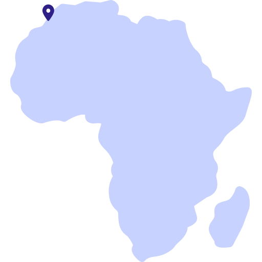
A Moroccan presence supporting infrastructure projects across Africa
Morocco now plays a strategic role in the development of infrastructure and digital transformation across the African continent.
Through Dotic Maroc, public and private organisations benefit from more than 18 years of expertise in geospatial data, territorial information systems and infrastructure management.
Being established in Morocco enables Dotic Maroc to better understand the operational realities, organisational contexts and local challenges encountered across African countries while leveraging the experience gained from numerous projects involving telecommunications, energy, water and urban infrastructure.
Expertise built alongside infrastructure managers

Dotic’s expertise is the result of more than 18 years working alongside network operators, infrastructure owners, utilities, public authorities and local governments facing real-world challenges related to infrastructure management, asset data governance and geospatial information.
Today, this experience provides a solid foundation for supporting Moroccan and African organisations addressing infrastructure growth, asset management and the modernisation of their information systems.
Our ambition is not to replicate models developed elsewhere, but to make proven expertise available in order to build solutions adapted to local realities, existing organisations and operational practices.
Because before managing infrastructure, planning investments or improving public services, organisations must first rely on reliable, consistent and sustainable data.
This mastery of geospatial data—from data modelling to operational value creation—remains at the heart of Dotic’s expertise.
Discover the extent of our know-how and expertise.