GIS solutions for infrastructure, network and geospatial data management in Africa




A software ecosystem designed for the realities of African infrastructures
Through Dotic Maroc, the Dotic Group provides telecom operators, network managers, infrastructure owners, utilities, local authorities and public organisations across Africa with a comprehensive ecosystem of software solutions dedicated to infrastructure and geospatial data management.
Telecommunications, energy, drinking water, wastewater, roads and urban infrastructure all share the same challenge across Morocco and Africa. As infrastructure networks continue to expand, the volume of data grows rapidly and organisations need solutions capable of structuring information, digitalising field operations and providing a reliable, shared view of their assets.
Across many African infrastructure projects, data is produced by multiple stakeholders, distributed across different information systems and used by a wide range of business teams. This fragmentation often makes it difficult to build a consistent understanding of infrastructure assets while limiting information sharing and operational collaboration.
Developed from more than 18 years of experience in Geographic Information Systems (GIS), asset management and geospatial data, Dotic solutions address these challenges by supporting the entire information lifecycle—from data collection and repository management to geospatial visualisation and advanced data exploitation.
Available as both SaaS and On-Premise solutions, they enable organisations to rapidly deploy proven software while retaining the flexibility required to adapt to their operational processes, organisational constraints and business objectives. Dotic Maroc also supports customers throughout solution integration, configuration and user adoption to ensure seamless integration with existing information systems and operational workflows.
Better infrastructure knowledge for better infrastructure management
Across Morocco and many African countries, infrastructure managers face several challenges simultaneously: digitalising field operations, structuring data produced by multiple stakeholders, improving information sharing across departments and making better use of available geospatial data.
These challenges affect not only telecom operators deploying new fibre and communication networks, but also organisations operating energy, water and urban infrastructure, as well as public authorities seeking to improve the management of their infrastructure assets.
To address these challenges, Dotic Maroc provides a complementary ecosystem of software solutions covering the entire geospatial data value chain—from field data collection and repository management to Web GIS visualisation and Artificial Intelligence-powered data analysis.
Whether deployed independently or as part of a fully integrated environment, these solutions enable organisations to progressively build an information system adapted to their operational needs and level of digital maturity.

Build a shared geospatial view of your infrastructure
Learn more about ConnectServices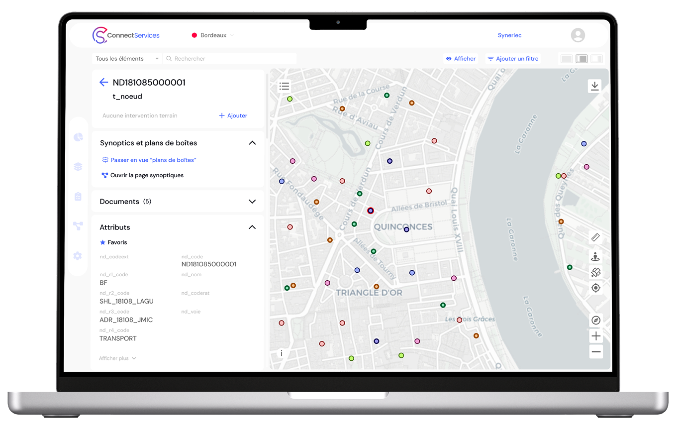
Infrastructure management involves a wide range of stakeholders, including infrastructure operators, utilities, engineering firms, contractors, local authorities and technical partners. Yet each often works with different datasets, software platforms and levels of information.
Across many African infrastructure projects, this fragmentation limits collaboration, complicates operational monitoring and prevents organisations from building a shared understanding of their infrastructure assets.
ConnectServices provides a single point of access to infrastructure data, ensuring that information remains consistent, shared and accessible to every stakeholder involved in the project.
ConnectServices is a collaborative Web GIS platform designed to centralise, visualise, analyse and share geospatial data within a single environment accessible to all authorised users. The platform extends access to infrastructure knowledge beyond GIS specialists, enabling operational teams, project managers, network operators and decision-makers to work from the same reliable source of information.
Through interactive mapping, spatial analysis, thematic visualisation, activity monitoring and performance dashboards, ConnectServices transforms geospatial data into practical decision-support tools. Users can explore infrastructure assets, combine multiple data sources, monitor project progress and access contextual information through an intuitive web interface.
The platform also includes advanced editing capabilities, allowing users to create, modify and update data directly within the Web GIS environment. This collaborative approach facilitates continuous repository maintenance while ensuring information remains reliable, up to date and immediately available for operational use.
Particularly well suited to telecommunications, energy, water utilities and territorial infrastructure management, ConnectServices helps organisations improve information sharing, strengthen collaboration between stakeholders and foster a true geospatial data culture across their projects.
Digitalise field operations and improve infrastructure data reliability
Learn more about ConnectFieldAcross the telecommunications, energy, water and urban infrastructure sectors, field teams play a critical role in creating and maintaining infrastructure data. Audits, asset inventories, inspections, construction monitoring, maintenance operations and equipment surveys generate essential information every day to support network knowledge and infrastructure management.
Across many African infrastructure projects, these activities still rely on a combination of office tools, paper forms and applications that are often disconnected from the organisation’s information systems. This makes intervention tracking more difficult, slows information sharing and increases the risk of errors and duplicate data entry.
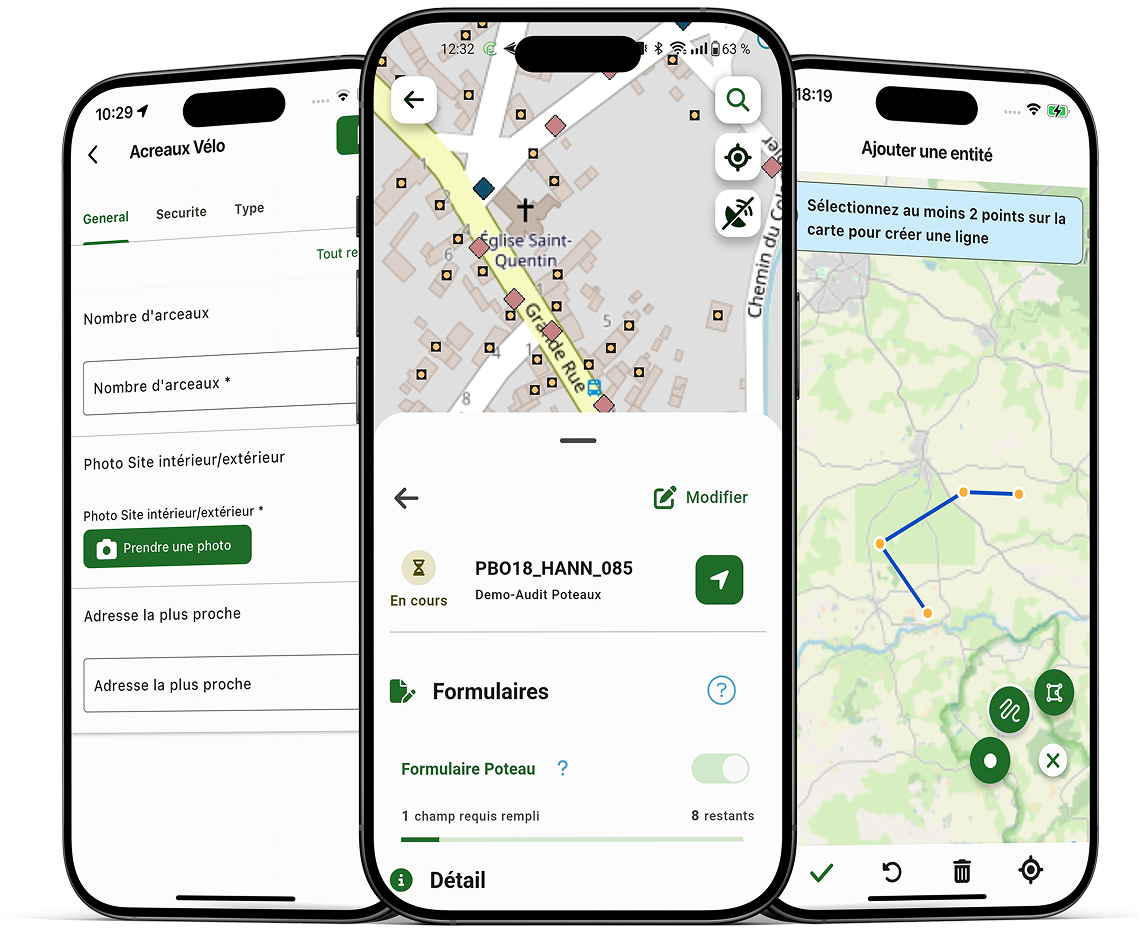
ConnectField is a mobile GIS application designed to digitalise field operations and enable the collection of reliable geospatial data directly at the source. The solution allows field teams to view assets on an interactive map, capture georeferenced observations, document inspections, attach photographs and update infrastructure information through configurable digital forms tailored to each organisation’s operational needs.
Particularly suited to audits, asset inventories, maintenance activities, construction monitoring and field inspections, ConnectField supports operational teams through an intuitive interface designed for non-GIS specialists. Its offline capabilities also enable uninterrupted fieldwork in areas with limited or no network connectivity.
When combined with the ConnectServices Web GIS platform, ConnectField also enables organisations to plan interventions, assign tasks, monitor operational progress and automatically synchronise collected data with the central information system. Information captured in the field becomes immediately available to project managers, infrastructure operators and decision-makers.
Far beyond simple field data collection, ConnectField helps organisations standardise operational workflows, improve intervention traceability and progressively build a more reliable and up-to-date understanding of their infrastructure assets.
Ensure data reliability before integration and operational use
Learn more about ConnectControl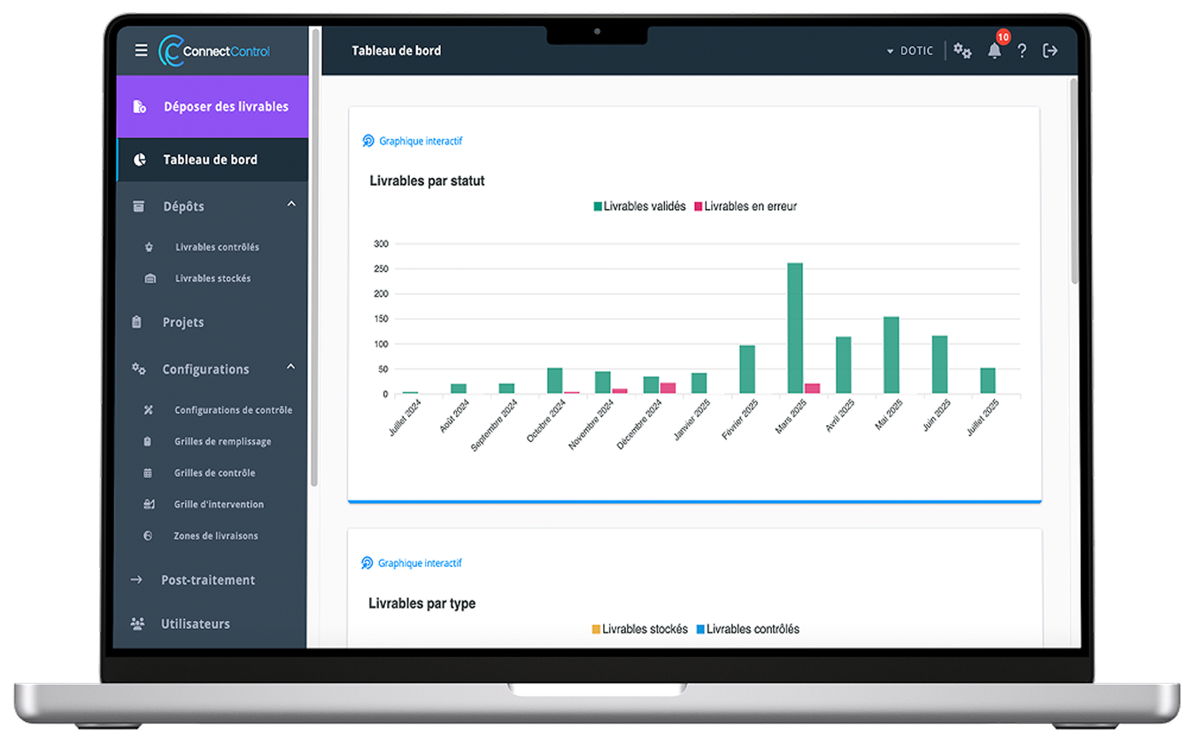
The quality of operational decisions depends directly on the quality of the data describing infrastructure assets. Yet across telecommunications, energy, water and urban infrastructure projects, information is often collected from multiple sources and produced by different stakeholders throughout the lifecycle of the network.
In many African contexts, organisations must also manage heterogeneous legacy datasets, asset repositories that are still under construction and data management practices evolving alongside the digitalisation of operations. The challenge therefore extends beyond simply validating collected information—it also involves organising data consistently and establishing the foundations of sustainable information governance.
ConnectControl supports this approach by providing a dedicated environment for the administration, structuring and governance of geospatial data. The platform enables organisations to design data models tailored to their operational requirements, consolidate information from multiple sources, manage data production processes and implement validation rules that ensure long-term consistency.
Particularly well suited to projects involving the creation or modernisation of infrastructure asset repositories, ConnectControl facilitates data consolidation, the integration of new datasets and the progressive implementation of shared data management standards across the organisation.
Beyond data quality control, ConnectControl provides a complete framework for structuring and governing infrastructure data, enabling network operators and infrastructure owners to build reliable, scalable asset repositories aligned with their operational realities.
Unlock the full potential of geospatial data with Artificial Intelligence
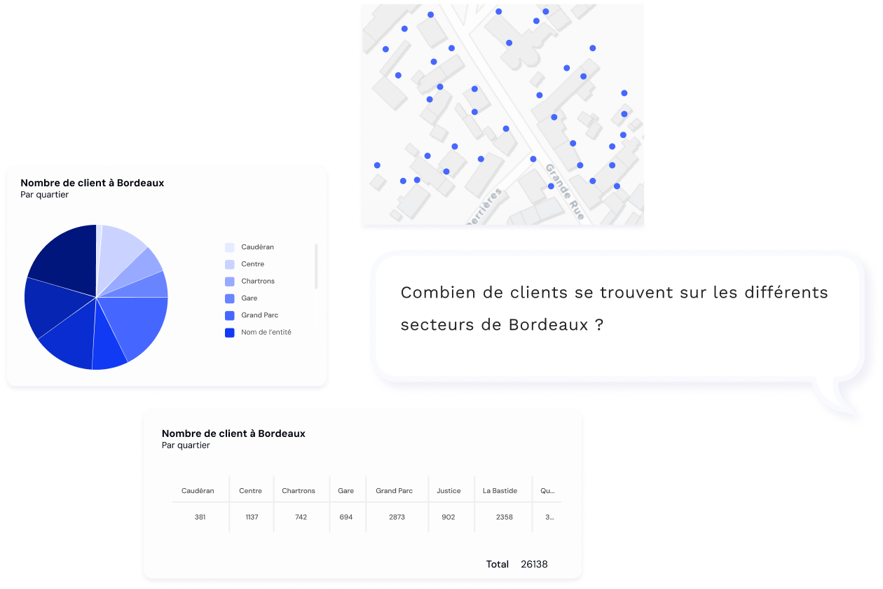
Learn more about ConnectQueryInfrastructure organisations now generate growing volumes of information from GIS platforms, operational databases, maintenance reports and technical documentation. Yet access to this information often remains limited to specialists with advanced GIS or data analysis skills.
ConnectQuery was designed to democratise the analysis and exploitation of geospatial data by allowing users to interact with their information using natural language—without requiring complex SQL queries or specialised Business Intelligence tools. Artificial Intelligence automatically translates business questions into meaningful analyses.
Users can search for infrastructure assets, analyse key performance indicators, identify priority areas and automatically generate maps, dashboards, charts and reports simply by asking questions in plain language.
Particularly well suited to infrastructure managers, network operators and public organisations, ConnectQuery makes geospatial information more accessible and accelerates decision-making by transforming complex datasets into clear, actionable insights.
Results can be presented as interactive maps, dashboards, charts or performance indicators directly usable by operational teams and decision-makers.
Proven solutions supporting the digital transformation of african infrastructure
The solutions offered by Dotic Maroc are built upon more than 18 years of expertise in Geographic Information Systems (GIS), infrastructure management and geospatial data.
Already deployed across the telecommunications, energy, water and territorial infrastructure sectors, they help organisations structure their data, modernise operational processes and strengthen knowledge of their infrastructure assets.
Their modular architecture enables organisations to deploy solutions progressively according to their priorities and level of digital maturity while ensuring seamless interoperability across the entire software ecosystem.
Through Dotic Maroc, these solutions contribute to the digital transformation of African infrastructure by making geospatial data more accessible, more reliable and easier to exploit for every stakeholder involved.

Beyond software, Dotic Maroc supports the success of your projects
Dotic solutions are designed to be deployed quickly and efficiently. Their long-term success, however, depends on their ability to integrate seamlessly with existing organisations, operational processes and information systems.
Whether deploying a Web GIS platform, digitalising field operations, building an infrastructure asset repository or making better use of existing geospatial data, successful implementation relies on expert guidance throughout the project.
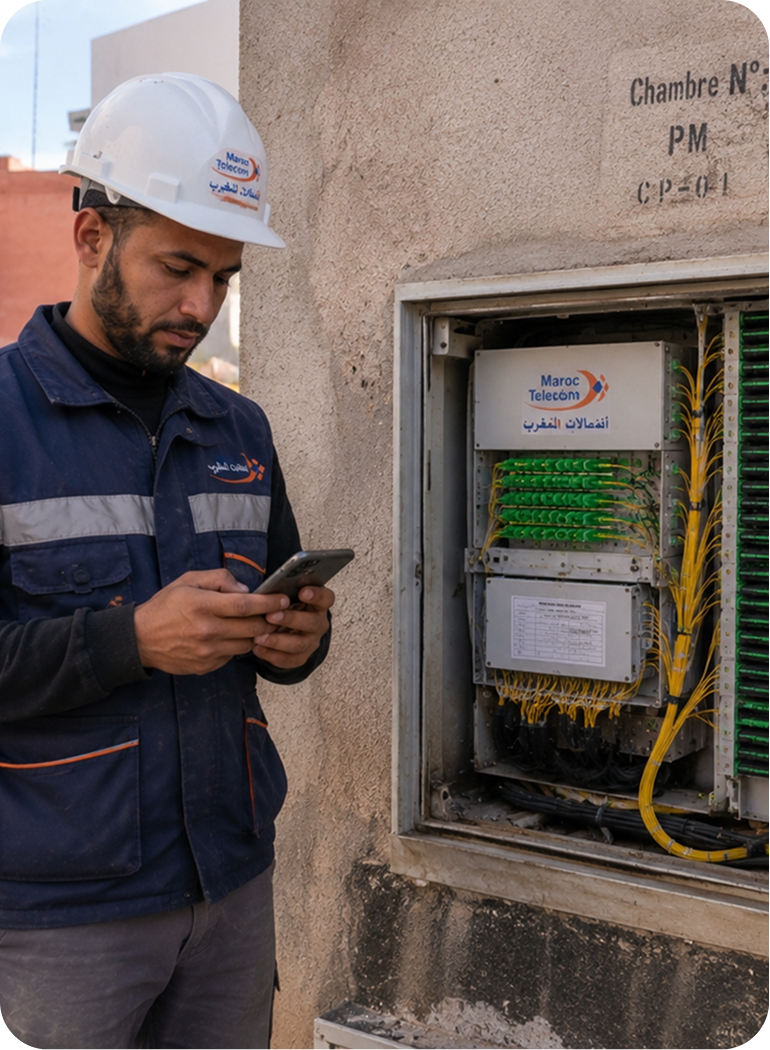
Dotic Maroc supports public and private organisations during the integration, configuration and deployment of its solutions to ensure they meet the operational requirements of every project.
Our support services may include business needs assessment, solution configuration, integration with existing systems, data migration, user training and go-live assistance.
This approach enables organisations not only to benefit from proven software solutions, but also from the expertise required to accelerate user adoption and maximise the value of their investment in infrastructure and geospatial data management.
Discover the extent of our know-how and expertise.